#40 deep space

The magnificent starburst galaxy Messier 82.
Deep Space — Psiu Puxa Space Wallpapers
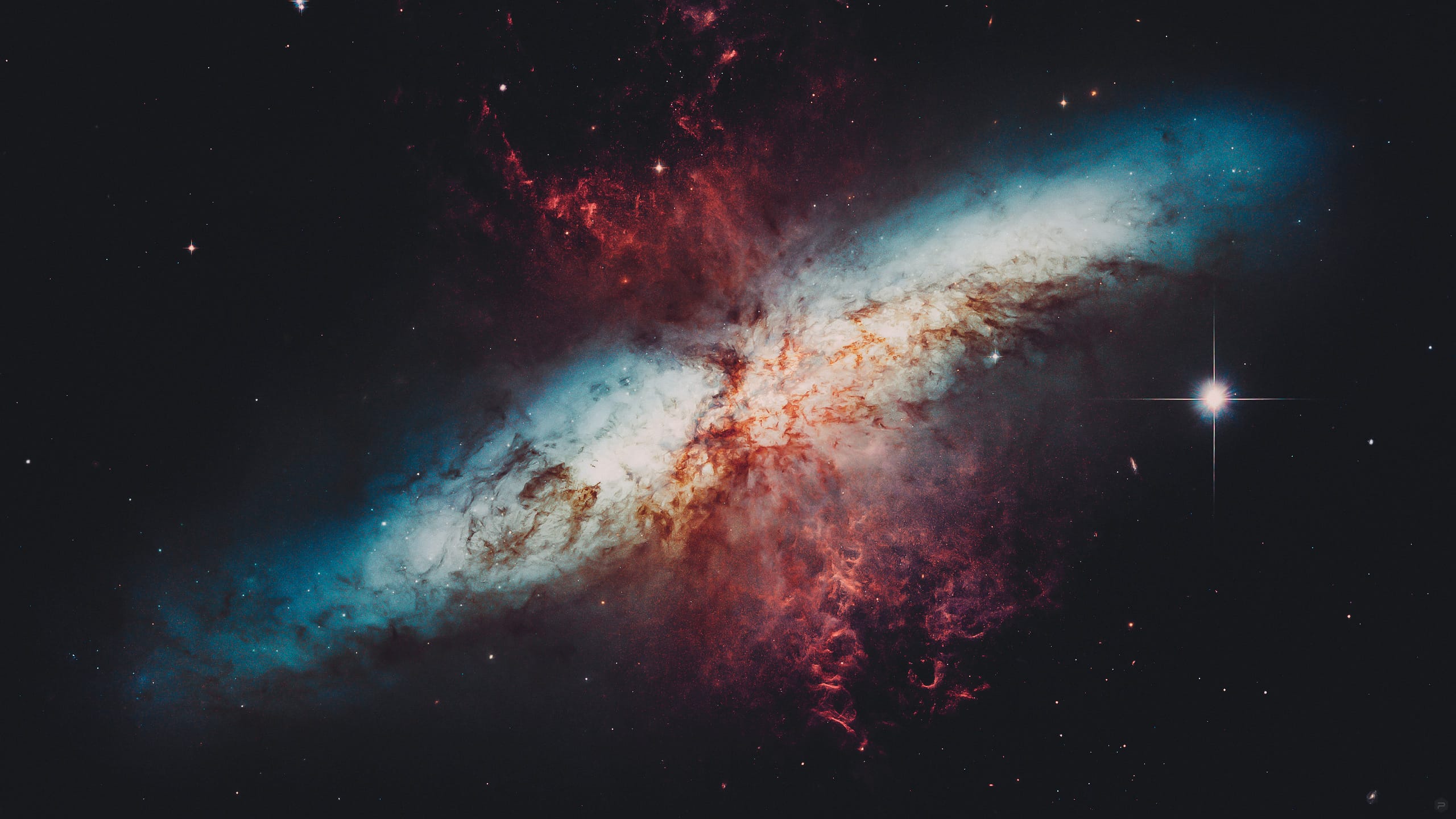
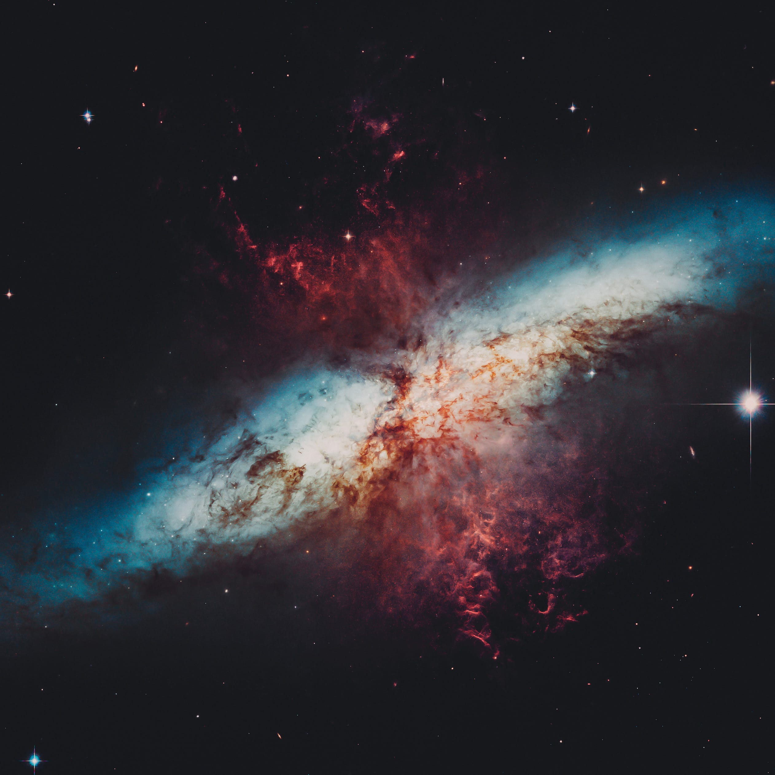
This mosaic image of the magnificent starburst galaxy, Messier 82 (M82) is the sharpest wide-angle view ever obtained of M82. It is a galaxy remarkable for its webs of shredded clouds and flame-like plumes of glowing hydrogen blasting out from its central regions where young stars are being born 10 times faster than they are inside in our Milky Way Galaxy.

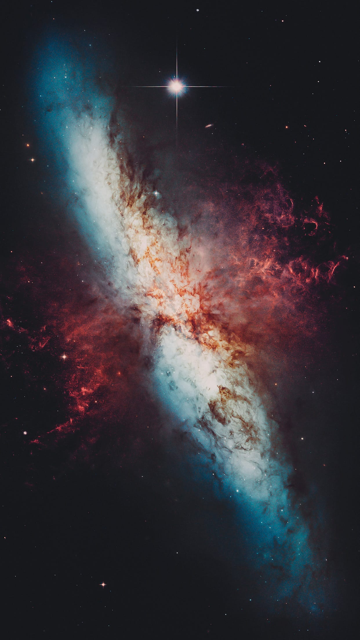
Messier 82 (also known as NGC 3034, Cigar Galaxy or M82) is a starburst galaxy about 12 million light-years away in the constellation Ursa Major. It is about five times more luminous than the whole Milky Way and one hundred times more luminous than our galaxy's center. The starburst activity is thought to be triggered by interaction with neighboring galaxy M81, and M82 is a member of the M81 Group. As the closest starburst galaxy to our own, M82 is the prototypical example of this type of galaxy. SN 2014J, a Type Ia supernova, was observed in the galaxy on 21 January 2014. In 2014, in studying M82, scientists discovered the brightest pulsar yet known, designated M82 X-2.

Credit: NASA, ESA and the Hubble Heritage Team STScI/AURA). Acknowledgment: J. Gallagher (University of Wisconsin), M. Mountain (STScI) and P. Puxley (NSF).

#39 MARTIAN TERRAIN

Future Mars Landing Site in Antoniadi Crater.
Martian Terrain — Psiu Puxa Space Wallpapers
Candidate landing site in Antoniadi Crater for future Mars missions.

#38 MARTIAN TERRAIN

Future Exploration/Landing Sites.
Martian Terrain — Psiu Puxa Space Wallpapers
Lower Northwest Portion of Mound in Gale Crater.

#37 MARTIAN TERRAIN

Uplifted Bedrock in the Central Peak of an Impact Crater
Martian Terrain — Psiu Puxa Space Wallpapers
Large impact craters expose deep bedrock. After the transient cavity forms, the crater floor rebounds and creates a permanent structural uplift, typically equivalent to about 10 percent of the crater diameter.

A crater approximately 70 kilometers (43 miles) wide like this one can raise up and expose bedrock that was approximately 7 kilometers (4 miles) lower in elevation prior to the impact. Deeper rocks are usually older, and on Mars the oldest rocks are interesting because they are more likely to have been altered by water and provide clues to ancient environments and processes.

This image reveals good bedrock exposures with diverse rock types (as indicated by colors and textures).

Written by: Alfred McEwen

#36 MARTIAN TERRAIN

Bright and Dark Slope Streaks in Arabia Terra
Martian Terrain — Psiu Puxa Space Wallpapers
While HiRISE has imaged slope streaks before, bright streaks are not as common as dark ones, so they're of high interest.

Slope streaks are generally small features, and have an interior roughness that is finer than the width of the streak itself. A high resolution image can help identify the characteristics of this roughness.

Additionally, studying these streaks can shed light on the "life cycle" of a streak and the geologic processes that created them. We may also be able to study the photometric properties of the streaks.

(Note: the above image is not map-projected, so north is approximate down).

This caption is based on the original science rationale.

Written by: HiRISE Science Team

#35 MARTIAN TERRAIN

Wrinkle Ridges in Eastern Meridiani Planum.
Martian Terrain — Psiu Puxa Space Wallpapers
This wrinkle ridge crosses through a mound of layered material that's been exposed by erosion.

This observation poses an excellent opportunity to look at the internal structure of a wrinkle ridge. We can compare the topography and internal structure of this wrinkle ridge at this location to exposures in other terrain to see if the local bedrock has a noticeable effect on ridge morphology or growth.

The layers also represent stratigraphic markers that we know were once continuous - examining faults that cross-cut and offset layers can yield good information about the amount and direction of movement that took place along that fault.

Written by: HiRISE Science Team

#34 MARTIAN TERRAIN

The Gemstone Floor of Noctis Labyrinthus.
Martian Terrain — Psiu Puxa Space Wallpapers
The smooth light-toned deposits on the floor of Noctis Labyrinthus, a series of depressions at the westernmost end of Valles Marineris, may contain a form of hydrated silica, perhaps opal, which is a gemstone.

The opal could have formed by chemical weathering of basaltic lava flows or volcanic ash in the presence of water. Also visible in the left side of the enhanced-color subimage are sand dunes with two colors, perhaps due to dark sand covered in places by bright reddish dust, and an impact crater with dark ejecta. (The subimage width is 1.2 kilometers.)

Written by: Alfred McEwen

#33 MARTIAN TERRAIN

Eastern Valles Marineris Bedrock Stratigraphy and Falling Dunes.
Martian Terrain — Psiu Puxa Space Wallpapers
This image shows a transect of approximately 8-kilometers of Coprates Chasma wall stratigraphy, which includes (moving down sequence): the southern plateau, wall spurs, fans of eroded material, gullies, sand dunes, and canyon floor.

Dunes located in the center left show slip faces on the downhill side and aligned with the local gradient, indicating down slope transport (see subimage, white arrow). These "falling dunes" are a type of topographically-controlled sand dune that formed when down-slope winds were focused by the gully topography. Although rare across Mars, eastern Coprates Chasma has an abundance of these falling dunes, particularly on north-facing walls.

As with all dunes, wind regime, sediment supply, topography, and climate are all important factors in where dunes form and persist. An abundant sand supply from local wall layer and persistent down-slope winds are likely contributors to why these dunes are so common here.

Note: the above image (and the subimage) are non map-projected, so North is approximately down).

Also take a look at the digital terrain map made with this image pair.

Written by: Matthew Chojnacki

#32 MARTIAN landscape

Sets of Beds Inclined Toward Mount Sharp.
Martian Landscape — Psiu Puxa Space Wallpapers
This image from the Mast Camera (Mastcam) on NASA's Curiosity Mars rover looks to the west of the Kimberley waypoint on the rover's route to the base of Mount Sharp. The mountain lies to the left of the scene. The image shows sets of sandstone beds all inclined to the south (left) indicating progressive build-out of sediment toward Mount Sharp. These inclined beds are overlain in the background by horizontally bedded fine-grained sandstones that likely represent river deposits.

The Mastcam's left-eye camera recorded the component frames of this mosaic on April 4, 2014, during the 590th Martian day, or sol, of Curiosity's work on Mars. The color has been approximately white-balanced to resemble how the scene would appear under daytime lighting conditions on Earth. Figure 1 is a version with a superimposed scale bar of 100 centimeters (about 39 inches) in the foreground and a scale bar of 10 meters (about 33 feet) in the distance.

NASA's Jet Propulsion Laboratory, a division of the California Institute of Technology, Pasadena, manages the Mars Science Laboratory Project for NASA's Science Mission Directorate, Washington. JPL designed and built the project's Curiosity rover. Malin Space Science Systems, San Diego, built and operates the rover's Mastcam.

#31 MARTIAN TERRAIN

Well-Preserved Gullied Impact Crater.
Martian Terrain — Psiu Puxa Space Wallpapers.jpg
This observation shows us pristine gullies, some with bright deposits, and perhaps very recent.

In addition, there is exposed bedrock, which at HiRISE resolution, we can pick out fine details. Observations like this can also help gully modeling.

Written by: HiRISE Science Team
All original images are presented by:
547d825dd0db3b8058acab8d_nasa.png 547d828239b0bf7409a305d1_arizona.png 547d828cd0db3b8058acab91_esa.png 547d832bd0db3b8058acab97_hubble.png 547d83369e4d1e7609d4c35d_jpl.png