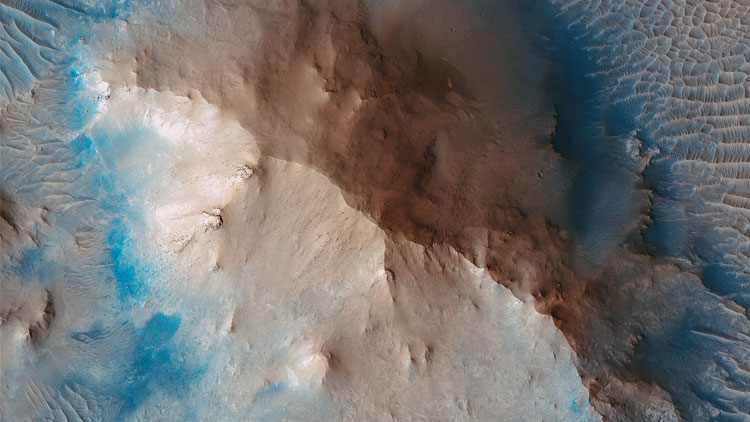
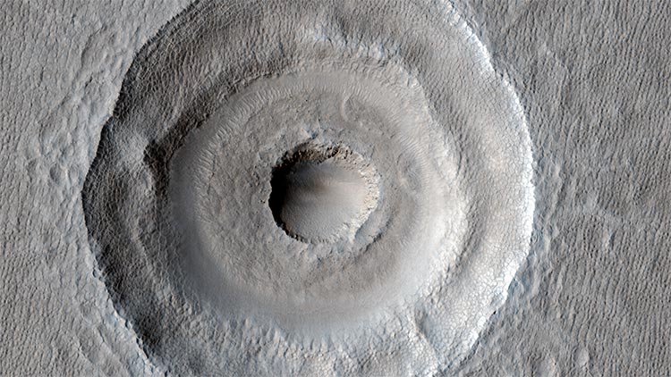
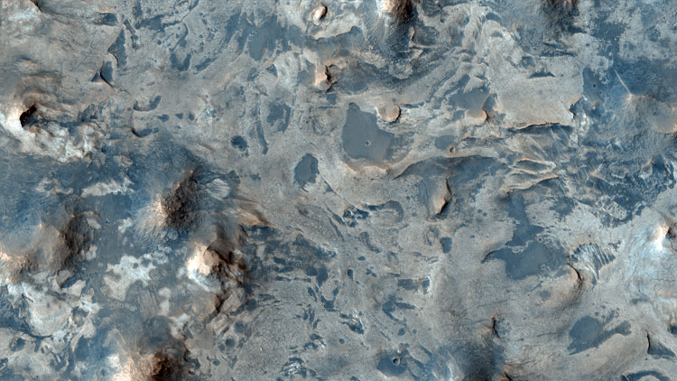
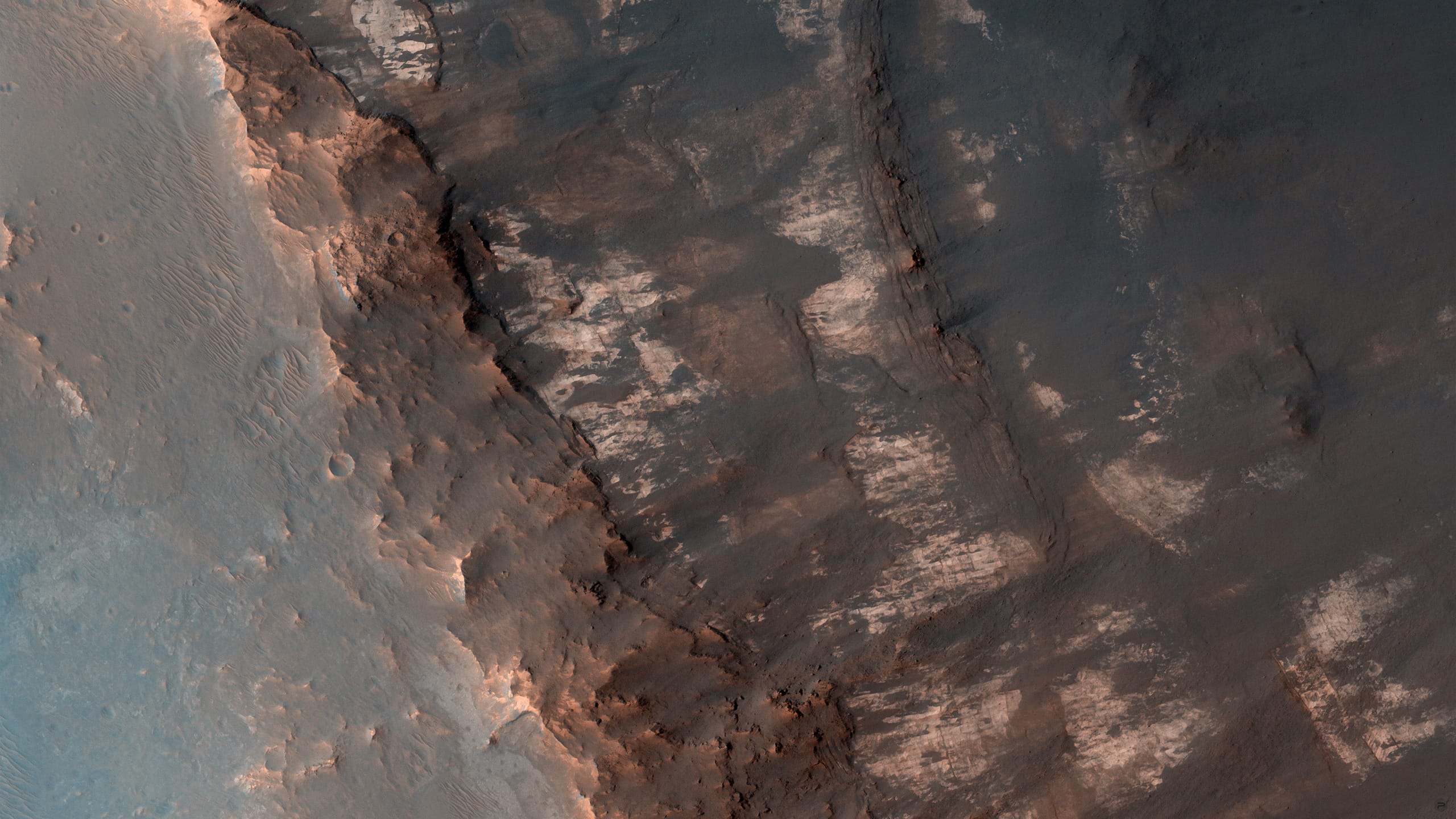
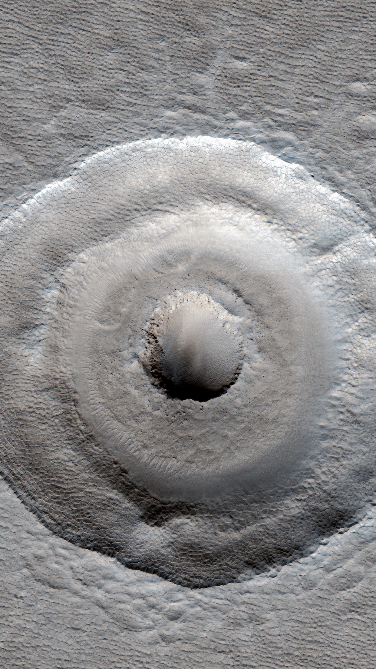
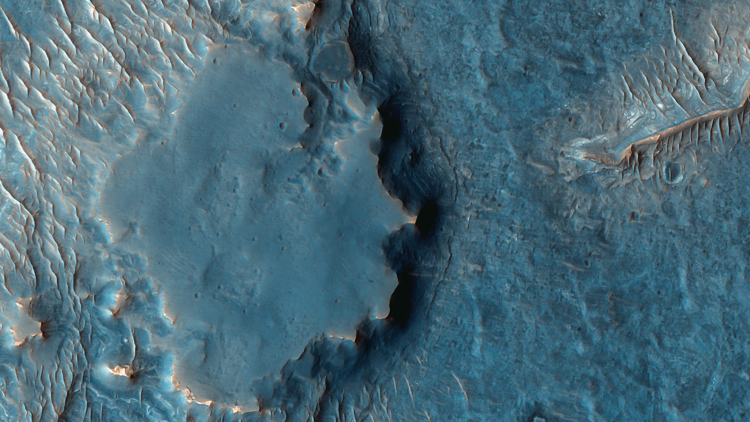
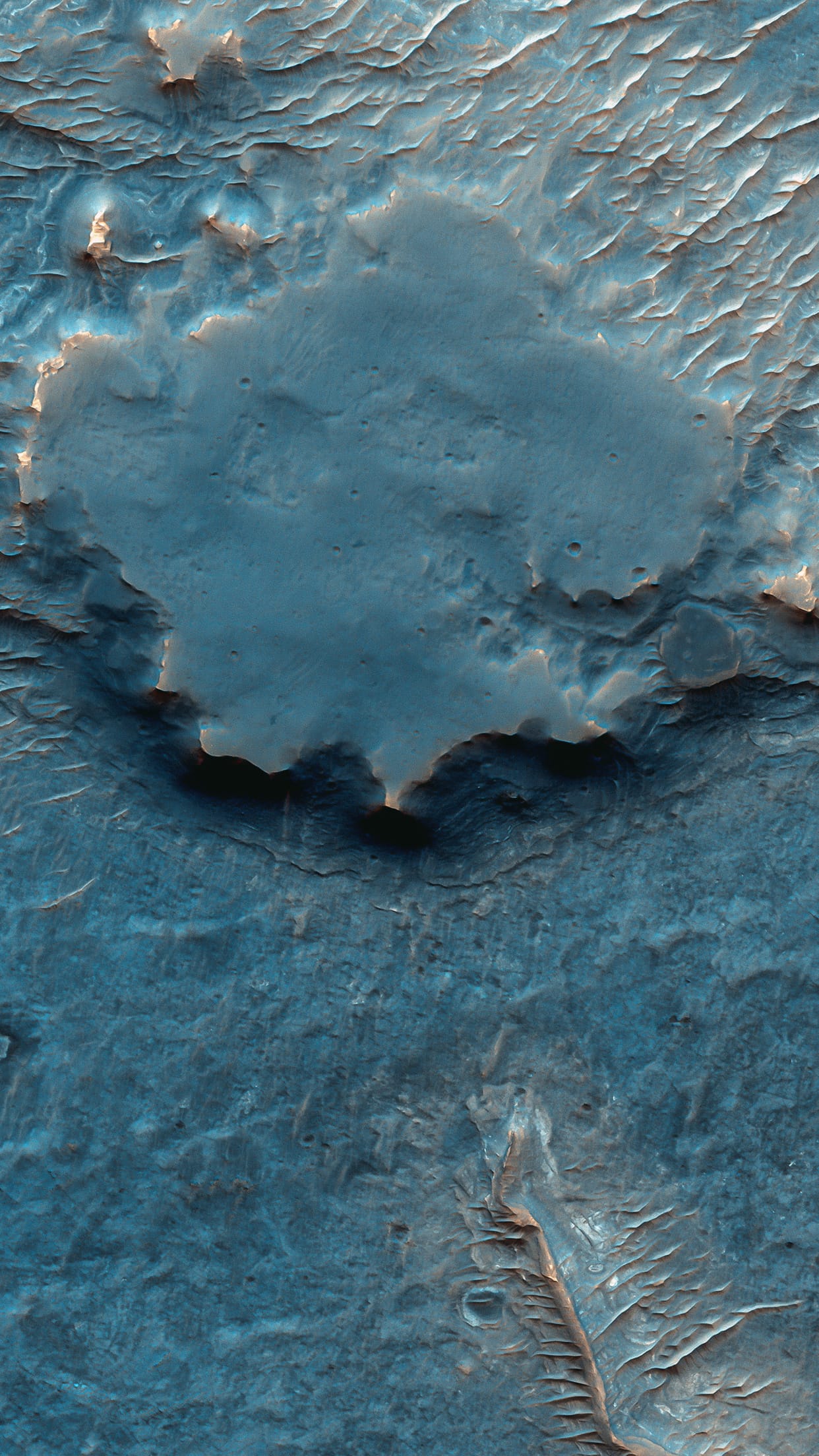
#50 MARTIAN TERRAIN

Geologic Contacts / Stratigraphy.
Martian Terrain — Psiu Puxa Space Wallpapers
Large Central Uplift of an Impact Crater

#49 MARTIAN TERRAIN

Layered Bedrock near Oyama Crater.
Martian Terrain — Psiu Puxa Space Wallpapers
Layered rock East of Oyama Crater and just west of Mawrth Vallis in HiRISE image ESP_016829_2040 provides information about bedding style and expression immediately beneath the ground at a candidate Mars Science Laboratory (MSL) field site.

This new observation on the west wall of the same crater further reveals these layered rocks for comparison with what we see on the north wall. These images serve to characterize the geologic setting of the potential landing site and rover explorations.

MSL is expected to launch in late 2011, landing on Mars in 2012. Mawrth Vallis is one of four candidate landing sites.

Written by: Alfred McEwen

#48 MARTIAN TERRAIN

Light-Toned Rocks inside a Crater.
Martian Terrain — Psiu Puxa Space Wallpapers
This approximately 20 kilometer diameter impact crater is located just to the south of Coprates Chasma in Valles Marineris.

Near the center of the crater are some light-toned rocks. These rocks are very jumbled and broken up rather than flat-lying and layered. These observations suggest that the light-toned rocks once existed below the current terrain and were brought up by the process that created the crater.

Several other craters around Valles Marineris also reveal light-toned rocks in their central peaks suggesting that the light-toned rocks are a regional unit that is buried beneath the lava plains that now surround Valles Marineris.

Written by: Cathy Weitz

#47 MARTIAN TERRAIN

Colorful Streaks.
Martian Terrain — Psiu Puxa Space Wallpapers
This is an image of the central pit of an impact crater in the ancient highlands.

The central uplifts of large impact craters often collapse to form pits on Mars, but they are still structural uplifts and often expose deep bedrock with diverse rock types which have a variety of colors.

In this enhanced color subimage, we see colorful streaks, where the bedrock is eroding, moving downhill a bit, then getting swept by the wind.

Written by: Alfred McEwen

#46 MARTIAN TERRAIN

Deposits on the Floor of Palos Crater.
Martian Terrain — Psiu Puxa Space Wallpapers
This image shows a portion of the floor in Palos Crater. The floor appears bumpy with high-standing layered knobs. Most of the terrain on the floor is weathering into meter-size polygonal blocks. The circular structures in the image, many of which are filled with darker aeolian material, are eroded impact craters.

Palos Crater is breached in the south by the 180 kilometers-long Tinto Vallis. Water transported along Tinto Vallis could have could have collected into Palos Crater to form a lake that later drained to the north. Sediments carried by Tinto Vallis would have also been deposited within Palos Crater so the layered unit we see along the floor today could represent these fluvial sediments.

Written by: Cathy Weitz

#45 MARTIAN TERRAIN

Bull's-Eye Impact Crater.
Martian Terrain — Psiu Puxa Space Wallpapers
What caused the central pit within this impact crater: unusual subsurface layering or a lucky second impact?

Impacts into layers of alternately strong and weak material – for example, ice rich versus non-ice-rich – produce terracing such as that seen between the inner pit and the outer rim. Scientists have used terraced craters to estimate the thickness of lava flows on the Moon and elsewhere. Uneven sublimation and periglacial erosion of exposed ice-rich material in the interior of the crater may explain why the small central pit is slightly offset from center relative to the terrace and rim of the larger crater.

The pit in the center of the main feature could also be from a later impact crater striking inside and slightly off-center from the original. It has a raised rim, which is characteristic of impact craters and is difficult to explain with a layered target. While no ejecta from this later impact can be seen, the ejecta could have been removed by extensive periglacial modification. Additionally, the floor fill around the inner crater resembles impact ejects elsewhere at this latitude, and some of the "landslides" to the East could be flow-back of ejecta off the walls of the larger crater.

Written by: Sarah Milkovich

#44 DEEP SPACE

Hubble image of the Ring Nebula (Messier 57).
Deep Space — Psiu Puxa Space Wallpapers
This new image shows the dramatic shape and colour of the Ring Nebula, otherwise known as Messier 57.

From Earth’s perspective, the nebula looks like a simple elliptical shape with a shaggy boundary. However, new observations combining existing ground-based data with new NASA/ESA Hubble Space Telescope data show that the nebula is shaped like a distorted doughnut. This doughnut has a rugby-ball-shaped region of lower-density material slotted into in its central “gap”, stretching towards and away from us.

Credit: NASA, ESA, and C. Robert O’Dell (Vanderbilt University).

#43 MARTIAN TERRAIN

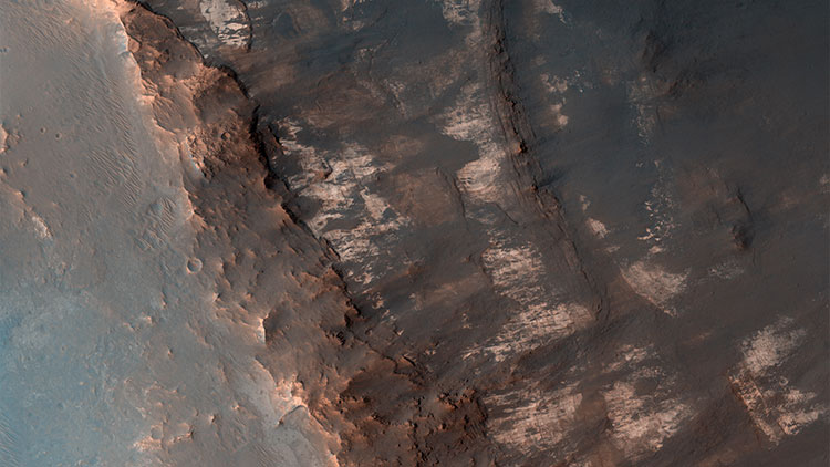
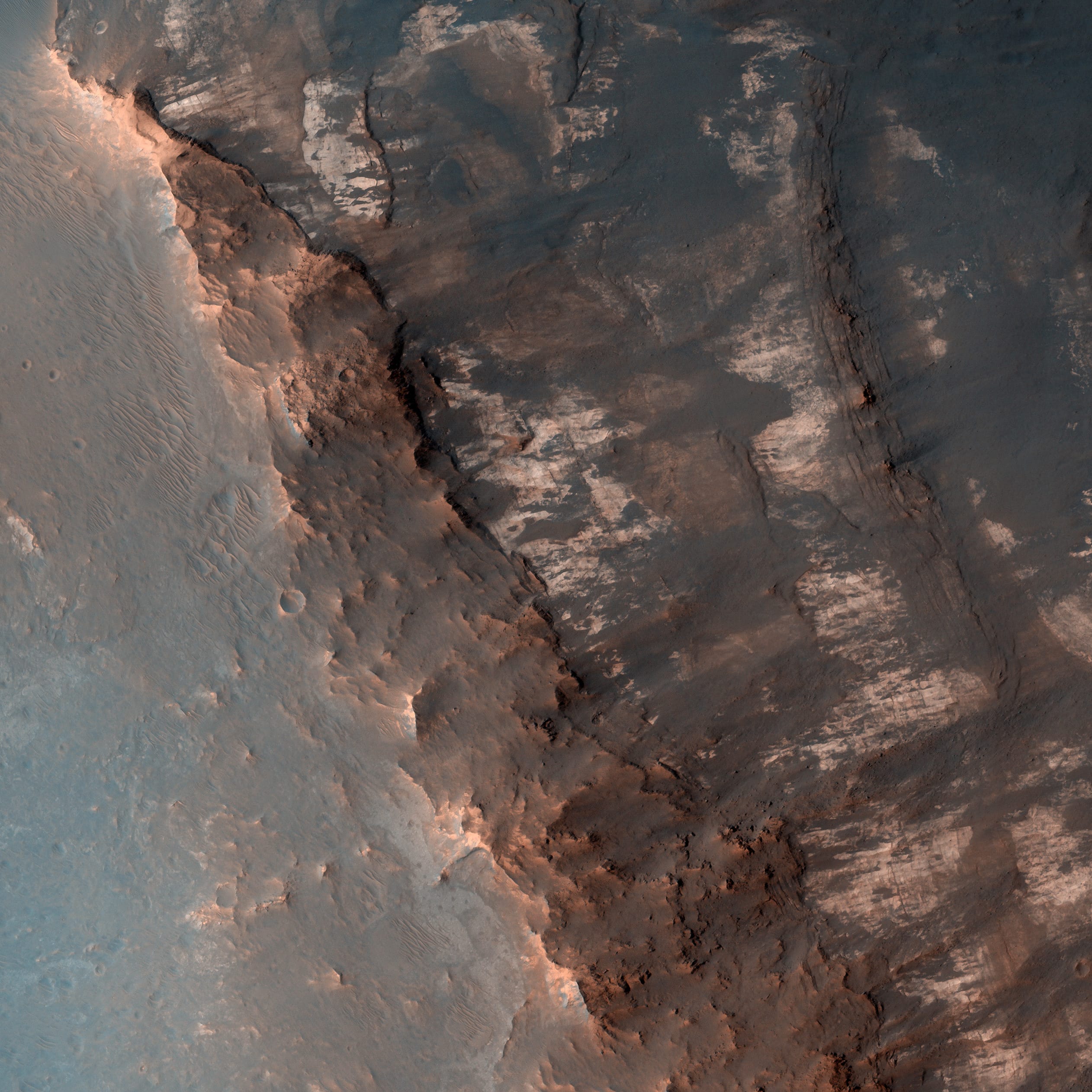
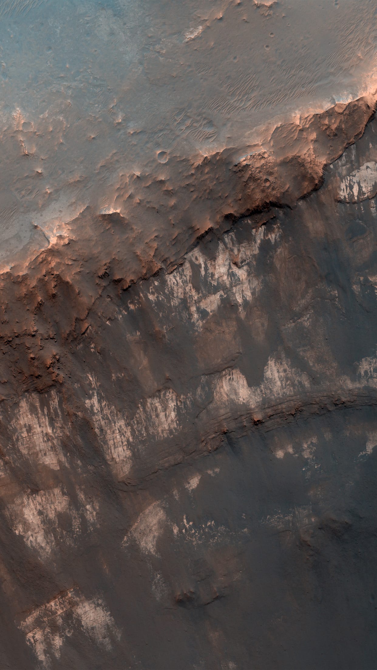
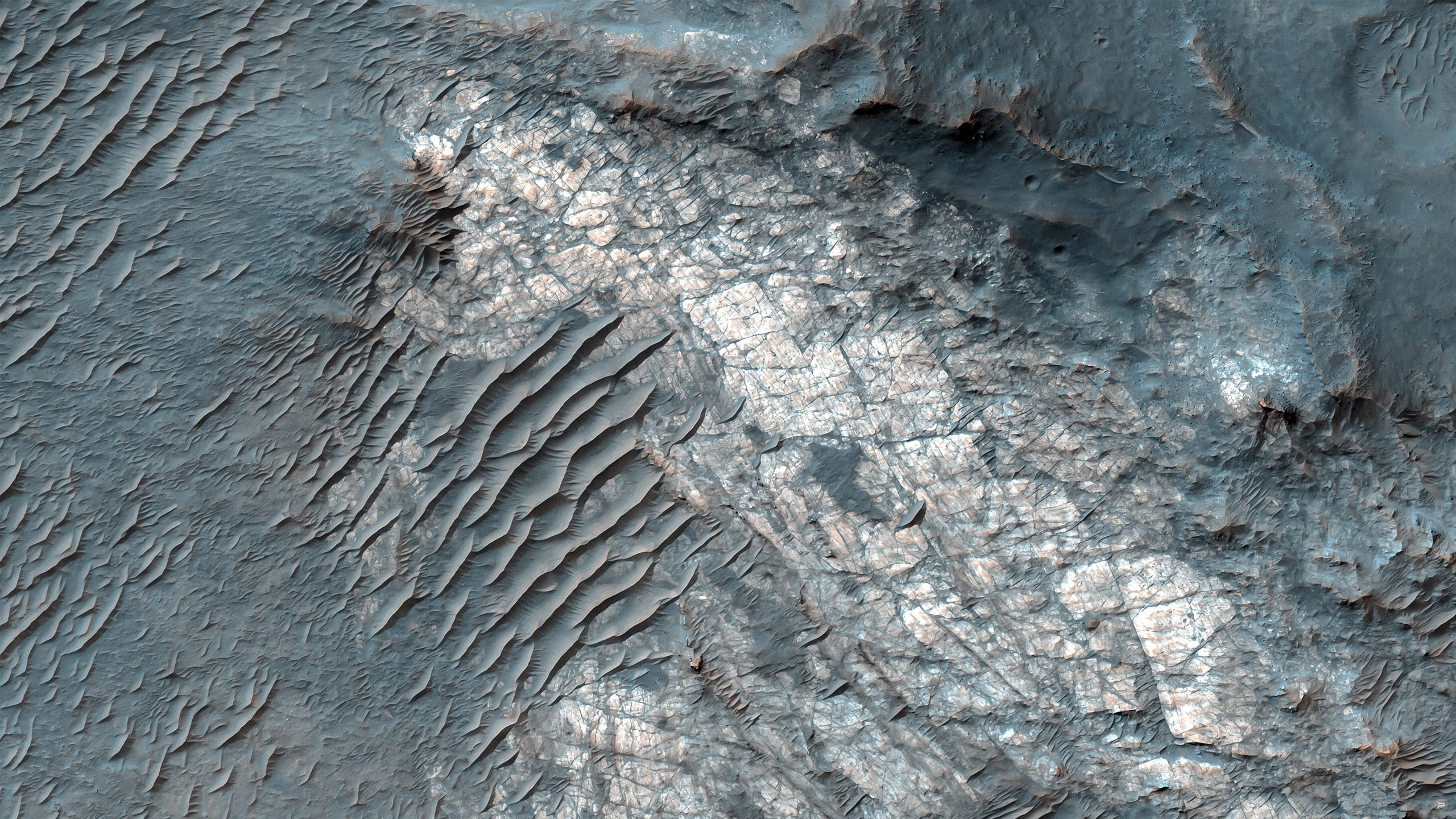
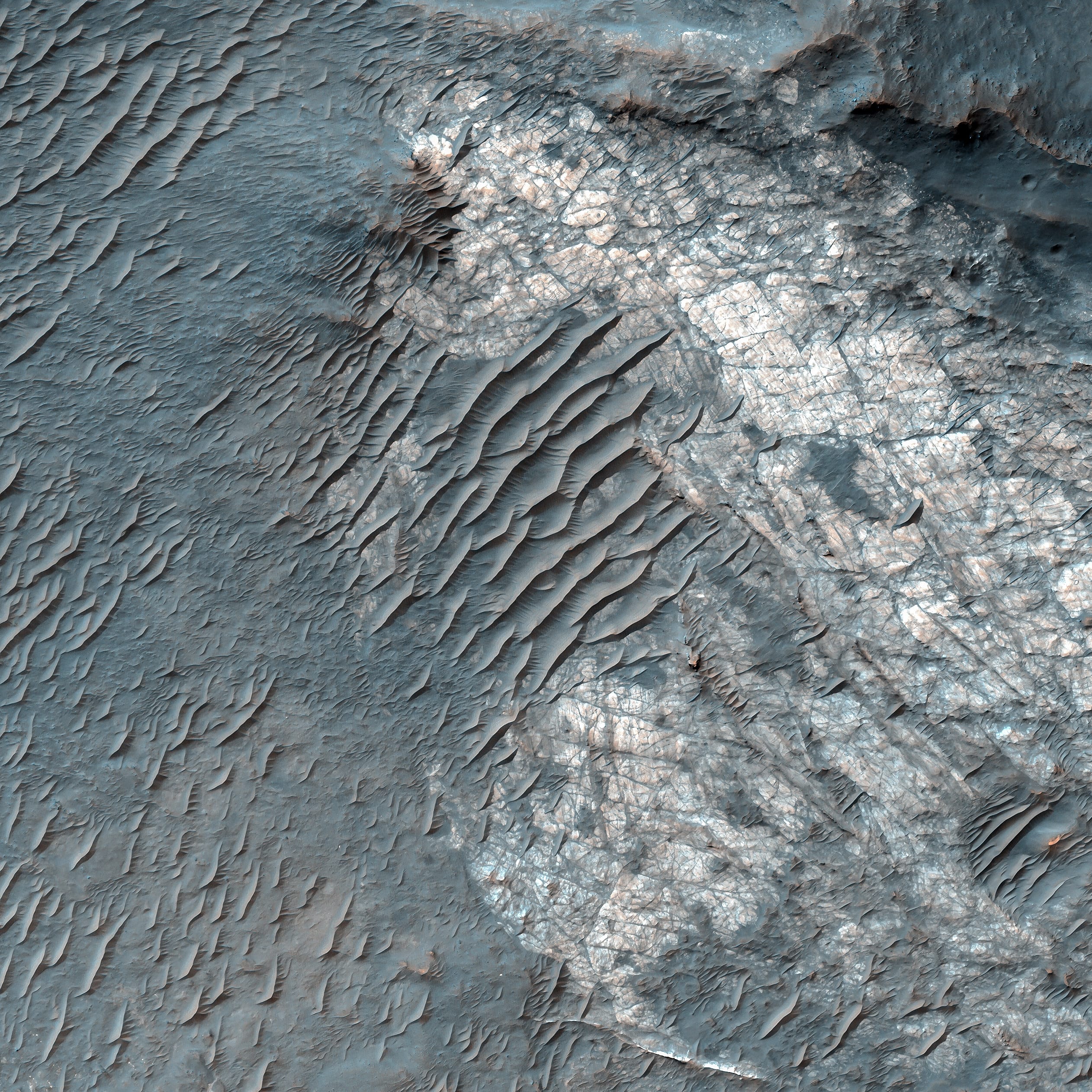
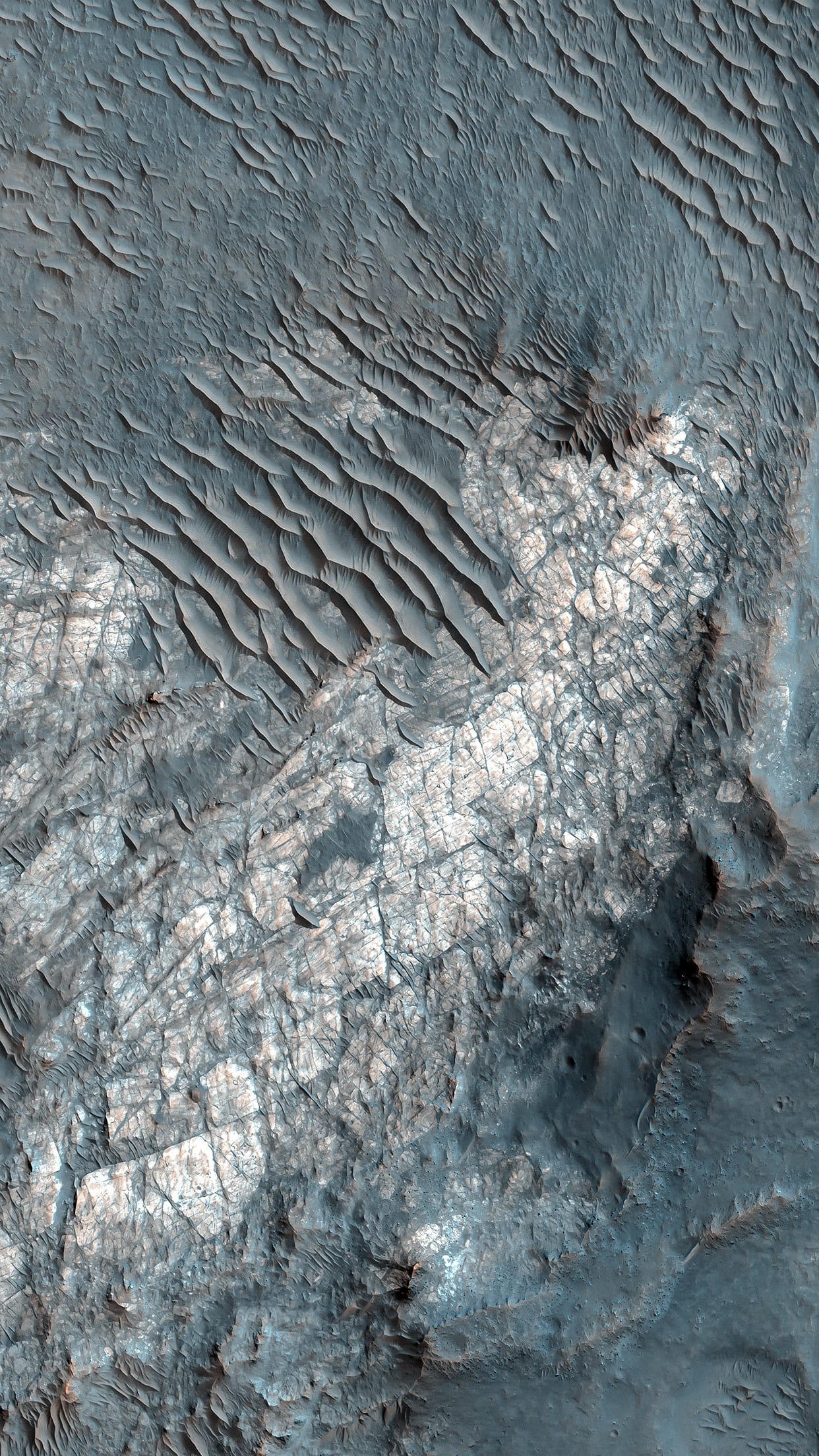
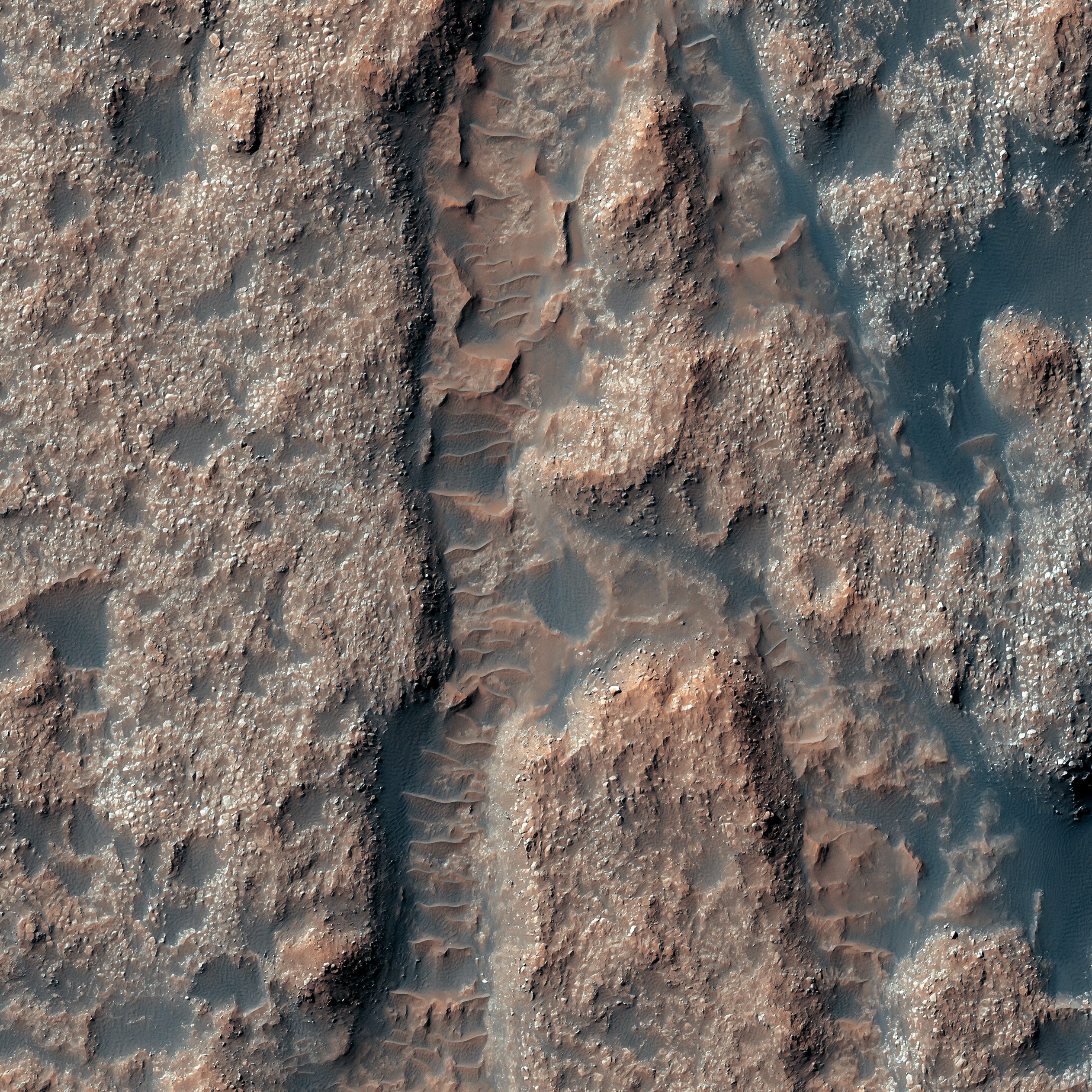
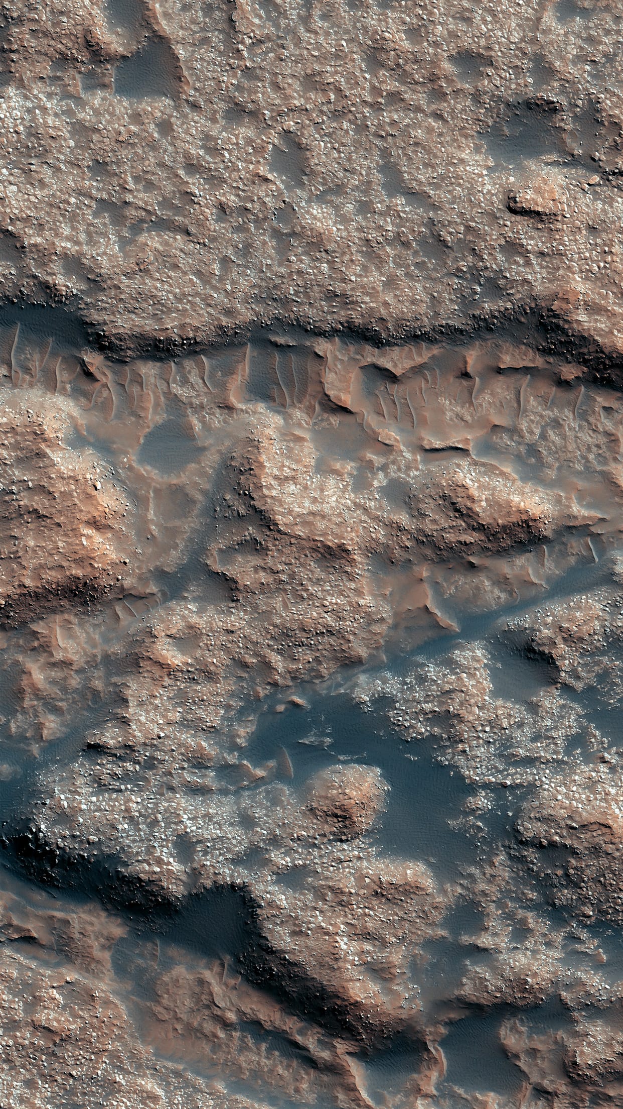
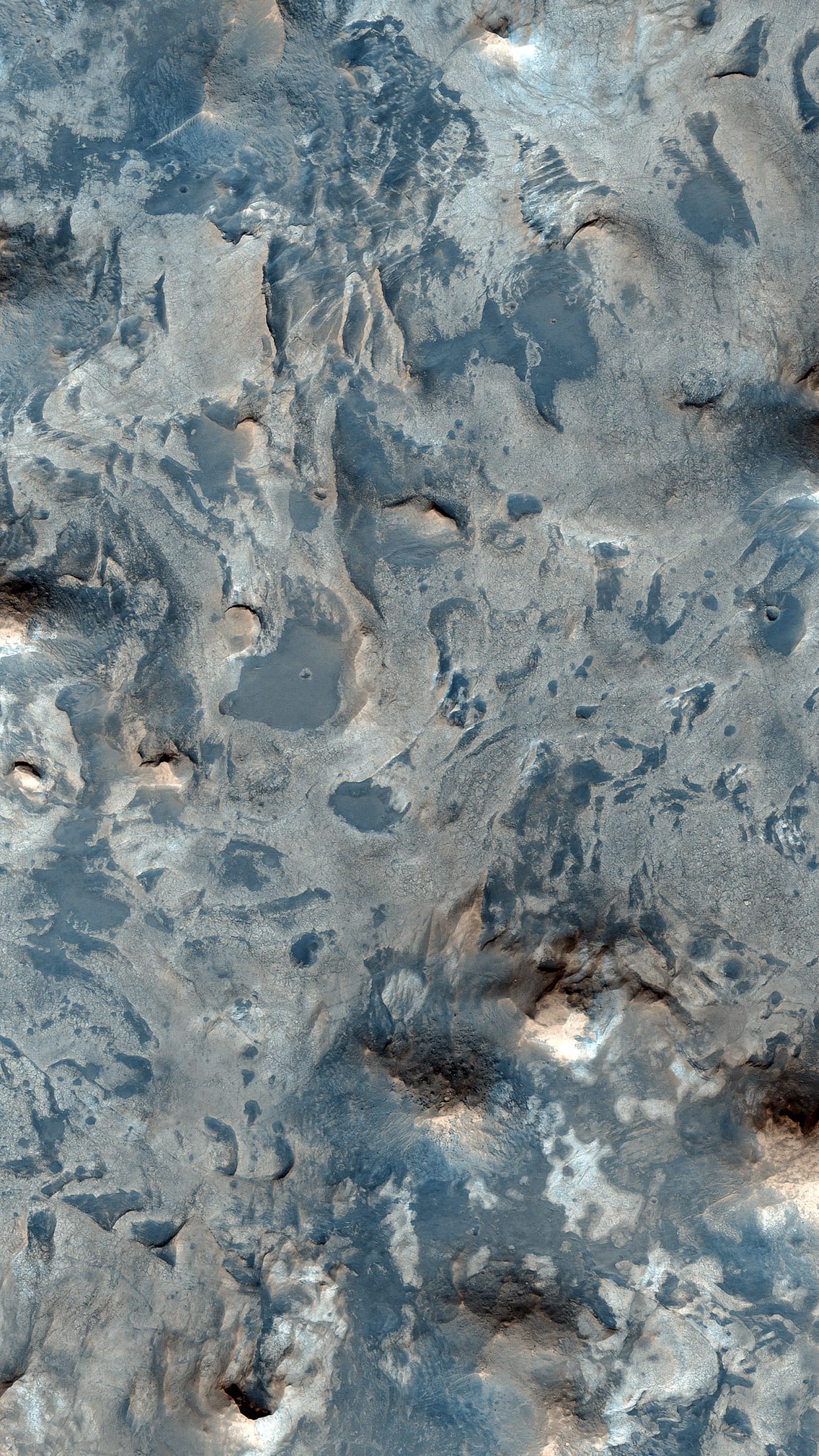
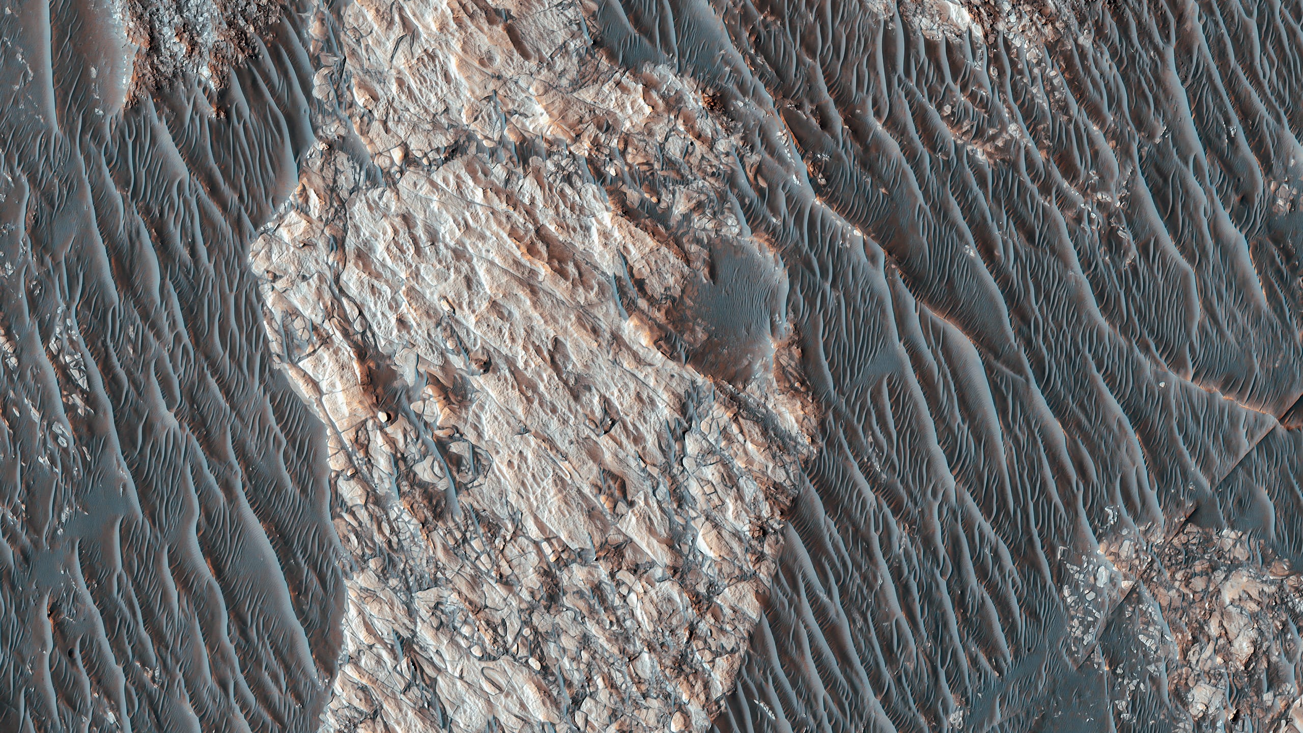
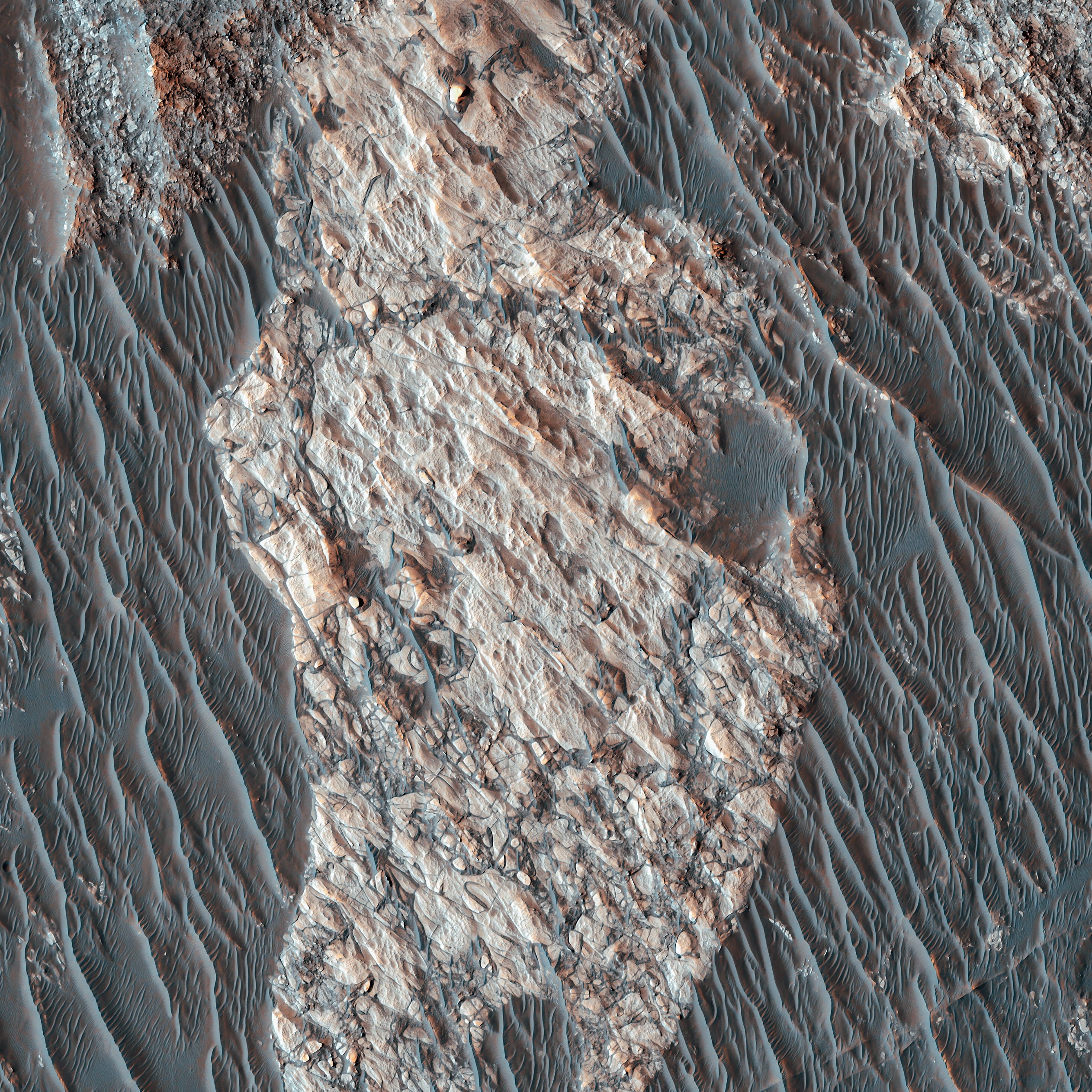
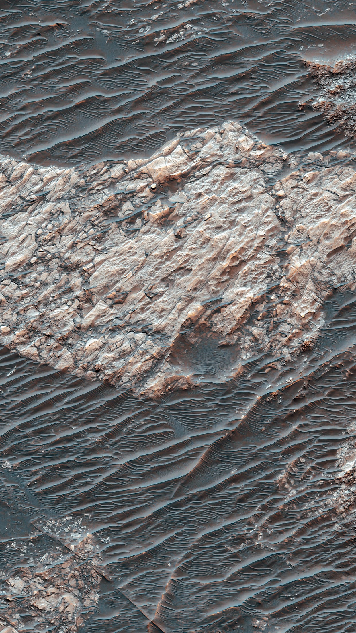
Inverted Topography near Juventae Chasma.
Martian Terrain — Psiu Puxa Space Wallpapers
This image displays several nice examples of inverted channels near Juventae Chasma, part of the Valles Marineris system.

Inverted topography - when a feature that ordinarily would be lower in elevation than the surrounding terrain is instead higher in elevation - forms when low-lying features are filled with erosion-resistant materials (like lava, large rocks or cemented sediments). The softer surrounding material is more easily eroded, which results in the filled-in feature becoming a high spot instead of a dip.

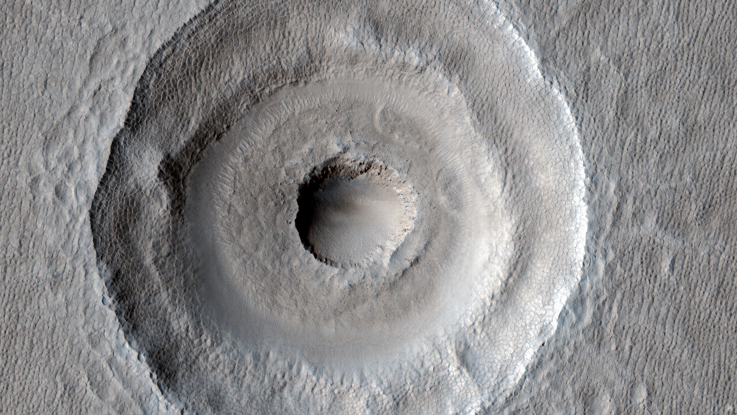
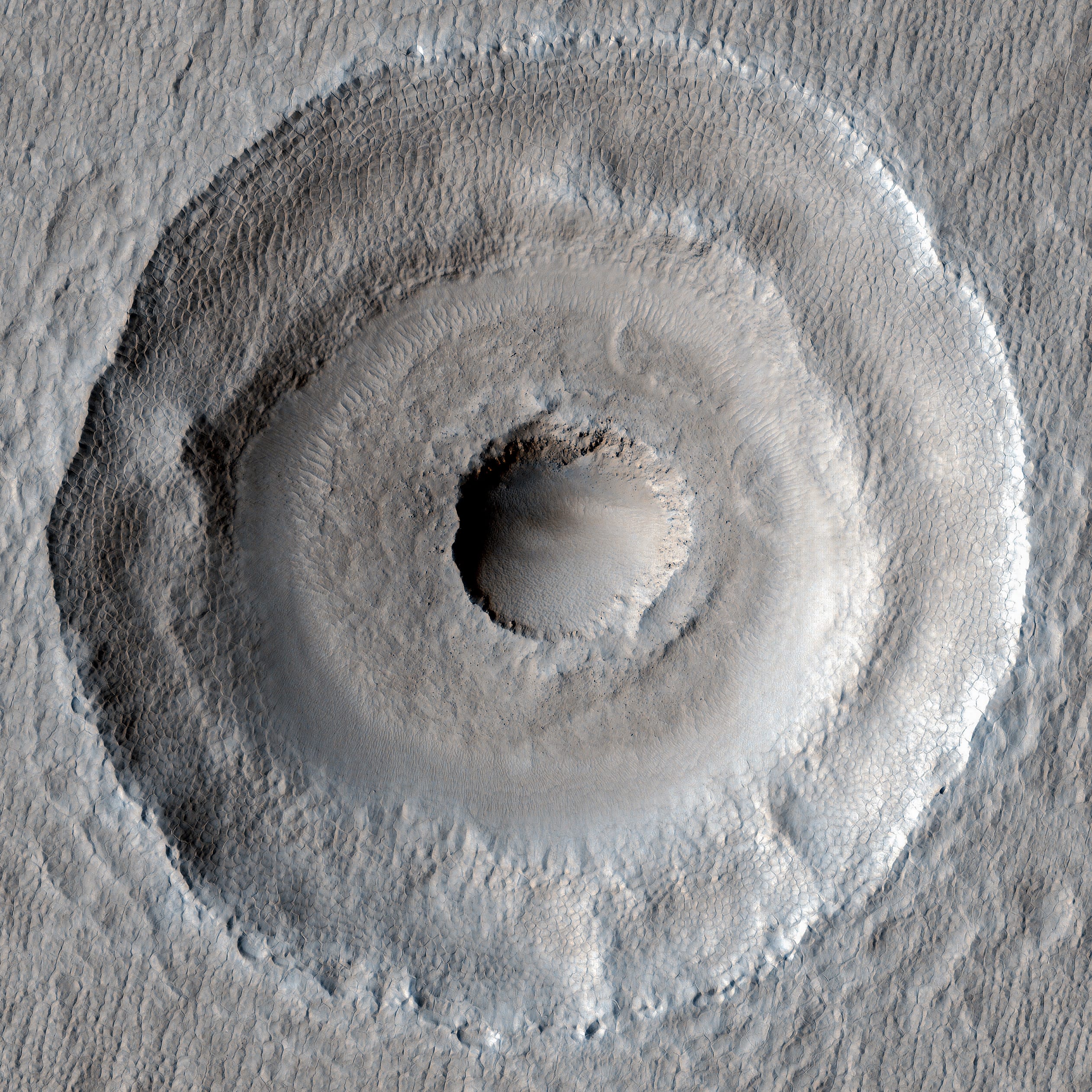
In this image, the inverted relief preserves sinuous branching features, possibly ancient streambeds. And while it isn't exactly inverted topography, several of the craters in the image also seem to have been subject to a similar process - the erosion-resistant ejecta blankets stand higher than the surrounding terrain, forming an abrupt transition at the edge of the ejecta.

Written by: Nicole Baugh

#42 MARTIAN TERRAIN

Bright Layers North of Meridiani Planum.
Martian Terrain — Psiu Puxa Space Wallpapers
This HiRISE image is located North of Meridiani Planum near the landing site of the Mars Exploration Rover Opportunity.

The surface adjacent to the edge of the crater is characterized by light-toned, regularly layered sedimentary rock, dark-toned material trapped in degraded crater floors, and knobs. The layered rocks are faulted (offset) in places and folded (see inset of false color image, 1 kilometer/0.6 miles across).

Written by: Sharon Wilson

#41 MARTIAN TERRAIN

Light-Toned Rock
Martian Terrain — Psiu Puxa Space Wallpapers
MOC and a single HiRISE image show some very interesting light-toned rocks and narrow ridges here. One of the justifications for this observation was to look for jointing and layering.

Written by: HiRISE Science Team
All original images are presented by:
547d825dd0db3b8058acab8d_nasa.png 547d828239b0bf7409a305d1_arizona.png 547d828cd0db3b8058acab91_esa.png 547d832bd0db3b8058acab97_hubble.png 547d83369e4d1e7609d4c35d_jpl.png